 QGIS (Quantum GIS) is a geographic information systems (GIS) application for viewing, editing, and analysing data. It allows layered map editing, composed of raster and vector (polygon) data, and allows georeferencing them. It's commonly used by OpenStreetMap and suitable for beginners, also available cross-platform.
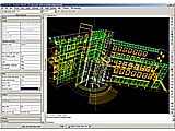 ZCAD is simple CAD program for technical drawings and electrical wirings and devices. It supports the DXF2000, DWG, PDF/PS/SVG/EPS and ZCP file formats and SHX or TTF fonts, is cross-platform, uses fast OpenGL rendering, allows polar tracking, accessible 2D and 3D object rotation and perspectivic view, and taking object snapshots.
 A DXF, DWG file viewer that integrates to the desktop.
|